District de Douma
Le District de Douma (en arabe : منطقة دوما, manṭiqat Dūmā) est l'un des dix districts du Gouvernorat de Rif Dimachq, situé dans le sud de la Syrie ; son centre administratif est la ville de Douma. D'après le Bureau central des statistiques syrien, sa population était de 433 719 habitants en 2004.
| District de Douma منطقة دوما (ar) | |
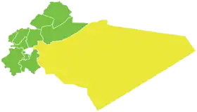 Localisation du district de Douma, dans le gouvernorat de Rif Dimachq. | |
| Administration | |
|---|---|
| Pays | |
| Gouvernorat | Rif Dimachq |
| Démographie | |
| Population | 433 719 hab. (2004) |
| Densité | 22 hab./km2 |
| Géographie | |
| Coordonnées | 33° 34′ 20″ nord, 36° 24′ 07″ est |
| Superficie | 1 987 592 ha = 19 875,92 km2 |
Sous-districts
Le district de Douma est divisé en sept sous-districts (ou nahiés), (population en 2004[1]) :
| Nom | Nom en arabe | Surface (km²) | Population | Code |
|---|---|---|---|---|
| Douma | دوما | 208,73 | 181 934 | SY030200 |
| Harasta | حرستا | 25,64 | 88 816 | SY030201 |
| Al-Sabe' Biyar | السبع بيار | 12 919,39 | 395 | SY030202 |
| Al-Dumayr | الضمير | 5 929,58 | 26 192 | SY030203 |
| Al-Nashabiyah | النشابية | 277,76 | 76 814 | SY030204 |
| Al-Ghizlaniyah | الغزلانية | 388,02 | 36 715 | SY030205 |
| Harran al-Awamid | حران العواميد | 126,80 | 22 853 | SY030206 |
Références
- Rapport de recensement du Bureau central des statistiques syrien (2004). (ar) Lire en ligne
.svg.png.webp) Portail de la Syrie
Portail de la Syrie
Cet article est issu de Wikipedia. Le texte est sous licence Creative Commons – Attribution – Partage à l’identique. Des conditions supplémentaires peuvent s’appliquer aux fichiers multimédias.