District d'az-Zabadan
Le District d'al-Zabadani (en arabe : منطقة الزبداني, manṭiqat al-Zabadani) est l'un des dix districts du Gouvernorat de Rif Dimachq, situé dans le sud de la Syrie ; son centre administratif est la ville d'al-Zabadani. D'après le Bureau central des statistiques syrien, sa population était de 63 780 habitants en 2004.
| District d'al-Zabadani منطقة الزبداني (ar) | |
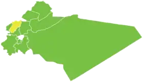 Localisation du district d'al-Zabadani, dans le gouvernorat de Rif Dimachq. | |
| Administration | |
|---|---|
| Pays | |
| Gouvernorat | Rif Dimachq |
| Démographie | |
| Population | 63 780 hab. (2004) |
| Densité | 162 hab./km2 |
| Géographie | |
| Coordonnées | 33° 43′ nord, 36° 05′ est |
| Superficie | 39 342 ha = 393,42 km2 |
Sous-districts
Le district d'al-Zabadani est divisé en trois sous-districts (ou nahiés), (population en 2004[1]) :
| Nom | Surface (km²) | Population | Code |
|---|---|---|---|
| al-Zabadani | 178,67 | 40 613 | SY030700 |
| Madaya | 93,37 | 13 692 | SY030701 |
| Serghaya | 121,37 | 9 475 | SY030702 |
Localités
| Nom | Nom en arabe | Population | Sous-district |
|---|---|---|---|
| al-Zabadani | الزبداني | 26 285 | al-Zabadani |
| Madaya | مضايا | 9 371 | Madaya |
| Serghaya | سرغايا | 7 501 | Serghaya |
| al-Rawdah | الروضة | 4 536 | al-Zabadani |
| Souq Wadi Barada | سوق وادي بردى | 3 678 | al-Zabadani |
| Bloudan | بلودان | 3 101 | al-Zabadani |
| Hurayra | هريرة | 2 455 | Madaya |
| Ain Hawr | عين حور | 1 974 | Serghaya |
| Baqin | بقين | 1 866 | Madaya |
| Kafr al-Awamid | كفر العواميد | 1 588 | al-Zabadani |
| Barheliya | برهليا | 821 | al-Zabadani |
| Hosh Bajed | حوش بجد | 604 | al-Zabadani |
Références
- Rapport de recensement du Bureau central des statistiques syrien (2004). (ar) Lire en ligne
.svg.png.webp) Portail de la Syrie
Portail de la Syrie
Cet article est issu de Wikipedia. Le texte est sous licence Creative Commons – Attribution – Partage à l’identique. Des conditions supplémentaires peuvent s’appliquer aux fichiers multimédias.