Arrondissement de Bamberg
L'arrondissement de Bamberg est un arrondissement ("Landkreis" en allemand) de Bavière (Allemagne) situé dans le district ("Regierungsbezirk" en allemand) de Haute-Franconie. Son chef lieu est Bamberg.
| Arrondissement de Bamberg Landkreis Bamberg | |
 Héraldique |
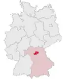 Localisation |
| Administration | |
|---|---|
| Pays | |
| Land | |
| District (Regierungsbezirk) |
Haute-Franconie |
| Chef-lieu | Bamberg |
| Villes principales | Hirschaid, Hallstadt |
| Préfet (Landrat) |
Johann Kalb |
| Partis au pouvoir | CSU |
| Code arrondissemental (Kreisschlüssel) |
09 4 71 |
| Immatriculation | BA |
| Communes | 36 |
| Démographie | |
| Population | 147 697 hab. (31 décembre 2021) |
| Densité | 127 hab./km2 |
| Géographie | |
| Superficie | 1 167,37 km2 |
| Localisation | |
.svg.png.webp)
| |
| Liens | |
| Site web | www.landkreis-bamberg.de |
Villes, communes & communautés d'administration
(nombre d'habitants en 2007)
Städte
| Baunach | 3 909 habitants | 30,9 km² | ||
| Hallstadt | 8 559 habitants | 14,5 km² | ||
| Scheßlitz | 7 160 habitants | 94,9 km² | ||
| Schlüsselfeld | 5 753 habitants | 70,2 km² |
Märkte
| Burgebrach | 6 466 habitants | 87,9 km² | ||
| Burgwindheim | 1 431 habitants | 37,4 km² | ||
| Buttenheim | 3 320 habitants | 30 km² | ||
| Ebrach | 1 845 habitants | 29,6 km² | ||
| Heiligenstadt | 3 642 habitants | 76,7 km² | ||
| Hirschaid | 11 666 habitants | 41 km² | ||
| Rattelsdorf | 4 531 habitants | 39,6 km² | ||
| Zapfendorf | 5 042 habitants | 30,6 km² |
Gemeinden
| Altendorf | 1 941 habitants | 8,6 km² | ||
| Bischberg | 6 037 habitants | 17,5 km² | ||
| Breitengüßbach | 4 614 habitants | 16,9 km² | ||
| Frensdorf | 4 887 habitants | 44 km² | ||
| Gerach | 1 005 habitants | 7,8 km² | ||
| Gundelsheim | 3 298 habitants | 3,8 km² | ||
| Kemmern | 2 554 habitants | 8,3 km² | ||
| Königsfeld | 1 352 habitants | 42,7 km² | ||
| Lauter | 1 150 habitants | 12,8 km² | ||
| Lisberg | 1 753 habitants | 8,4 km² | ||
| Litzendorf | 6 045 habitants | 25,9 km² | ||
| Memmelsdorf | 8 997 habitants | 26,2 km² | ||
| Oberhaid | 4 668 habitants | 27,2 km² | ||
| Pettstadt | 1 917 habitants | 9,9 km² | ||
| Pommersfelden | 2 937 habitants | 35,7 km² | ||
| Priesendorf | 1 534 habitants | 8,4 km² | ||
| Reckendorf | 2 043 habitants | 13,1 km² | ||
| Schönbrunn im Steigerwald | 1 935 habitants | 24,7 km² | ||
| Stadelhofen | 1 261 habitants | 41 km² | ||
| Stegaurach | 6 947 habitants | 23,9 km² | ||
| Strullendorf | 7 805 habitants | 31,7 km² | ||
| Viereth-Trunstadt | 3 645 habitants | 15,8 km² | ||
| Walsdorf | 2 600 habitants | 16,2 km² | ||
| Wattendorf | 700 habitants | 22,2 km² |
Verwaltungsgemeinschaften
| Verwaltungsgemeinschaft Baunach | Baunach, Gerach, Lauter et Reckendorf |
| Verwaltungsgemeinschaft Burgebrach | Burgebrach et Schönbrunn |
| Verwaltungsgemeinschaft Ebrach | Burgwindheim et Ebrach |
| Verwaltungsgemeinschaft Lisberg | Lisberg et Priesendorf |
| Verwaltungsgemeinschaft Stegaurach | Stegaurach et Walsdorf |
| Verwaltungsgemeinschaft Steinfeld | Königsfeld, Stadelhofen et Wattendorf |
Lieux et monuments

 |
Fränkische Straße der Skulpturen | Litzendorf |
 |
Gügel | Scheßlitz |
 |
Giechburg | Scheßlitz |
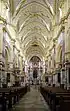 |
Kloster Ebrach | Ebrach |
 |
Schloss Greifenstein | Heiligenstadt |
| Sängerehrenmal Melkendorf | Litzendorf | |
| St. Wenzeslaus | Litzendorf | |
| Schloss Seehof | Memmelsdorf | |
| Schloss Weißenstein | Pommersfelden | |
 |
St.-Veit- und St.-Michaels-Kirche | Heiligenstadt |
.svg.png.webp) Portail de la Bavière
Portail de la Bavière
Cet article est issu de Wikipedia. Le texte est sous licence Creative Commons – Attribution – Partage à l’identique. Des conditions supplémentaires peuvent s’appliquer aux fichiers multimédias.